Products
PowerDecision Enterprise
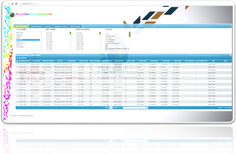
PowerDecision Enterprise protects and manage the Wells related infomrations like Logs, Markers, Perforation, Checkshots, Cores , G & G related data types like BHP, PPS data , Well Test Data and Production related data and maximizes your substantial data acquisition investment. Our application will search , browse and report data with flexible filtering This application has quick visualization with 3D, log viewer and reporting. An extensive functionality of exporting the log data into DLIS and LAS format, Excel and CVS format. Essence: Improving the user experience and workflow. This application has multi level security, staged loading and quality control.
Maximize the value of your E&P data
Oil field users need the ability to collect, find, edit, manage, and transfer data quickly and easily, allowing them to provide the right information to the right people at the right time in support of their business processes. The PowerDecision Enterprise data management and delivery system provides a powerful and broad solution for acquisition, management, and delivery of corporate data required by all disciplines across an E&P organization.
Our objective is to deliver the highest quality technical support in the industry. PIS Software Support is ensuring that we provide leading edge, best practices in technical on ground software support and Software maintenance.
Reduce information overload

Through the platform-neutral interface, you can leverage intuitive and compelling tools and capabilities for acquiring, browsing, querying, editing and controlling the quality of your data This integrated suite of technologies replaces stand-alone legacy products to maximize the value of your E&P data.
Log Viewer

Logs information window displays information about the well logging activity and the associated measurements. PiS Viewer window provides a visual indicator of your data before exporting the data to another application.
Map Viewer

Shows the location of oil and gas wells on a topographic basemap, oil and gas fields, structural contours
Deviation Survey

In both directional and straight holes, the position of the well must be known with reasonable accuracy to ensure the correct wellbore path and to know its position in the event a relief well must be drilled. The measurements themselves include inclination from vertical, and the azimuth (or compass heading) of the wellbore if the direction of the path is critical. Through which we will define a 3D curve for the user to understand the data and quality of the data
